


South Africans are being urged to brace for a noticeable drop in temperatures as winter systems strengthen across the country, with the South African Weather Service (SAWS) warning of a dynamic and increasingly cool weather pattern driven by two distinct atmospheric systems.
According to SAWS, a cut-off low-pressure system positioned along the west coast of Namibia is currently disrupting atmospheric stability over the western interior.

This system is expected to increase the chance of isolated showers and thundershowers across parts of the Northern Cape, where intermittent rainfall and noticeably cooler conditions are forecast.
At the same time, a broad surface high-pressure system anchored over South Africa’s eastern regions continues to influence weather conditions further east.
While less volatile, this system is sustaining widespread cloud cover, reinforcing cooler daytime temperatures, and maintaining a chance of isolated showers over Mpumalanga, eastern Limpopo and KwaZulu-Natal.
Against this broader synoptic setup, KwaZulu-Natal is expected to remain under a firmly entrenched cool and cloud-dominant pattern over the next two days, with limited and isolated rainfall activity anticipated.
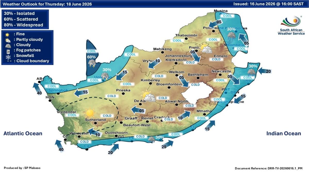
On Thursday, 18 June 2026, SAWS forecasts predominantly cool conditions across the province, including inland areas such as Newcastle.
Widespread cloud cover is expected to persist, accompanied by a 30% probability of showers, most likely along the coastal belt and northern districts.
Moderate easterly winds of between 15km/h and 25km/h are also expected, strengthening to between 30km/h and 40km/h along the southern coastline.
This is likely to introduce a noticeable wind-chill factor, particularly in exposed coastal areas and elevated inland regions.
Daytime temperatures are forecast to remain subdued. Coastal areas, including Durban and Richards Bay, are expected to reach between 16°C and 20°C, while inland areas such as Pietermaritzburg and Newcastle are forecast to see highs of between 14°C and 18°C.
Overnight conditions are expected to become sharply colder under persistent cloud cover.
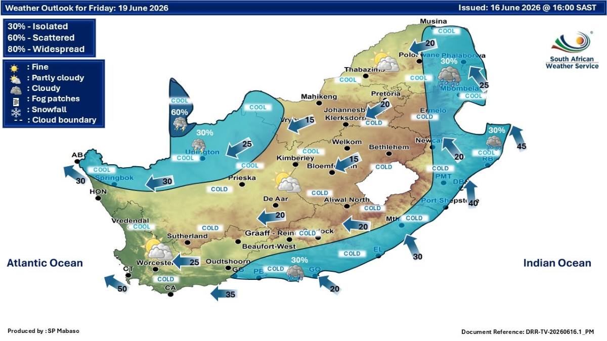
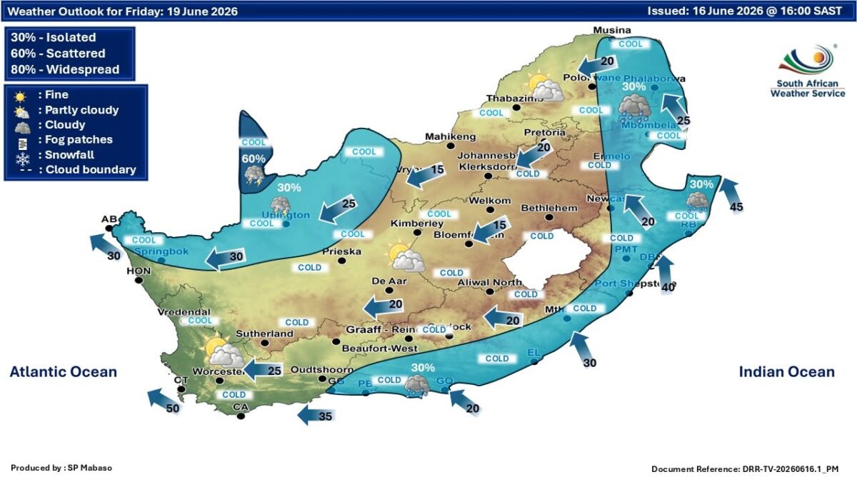
By Friday, 19 June 2026, SAWS indicates that similar conditions will continue as the high-pressure system remains dominant over the eastern half of the country.
Cloud cover is expected to stay widespread, with a slight increase in rainfall probabilities across the eastern and northern parts of KwaZulu-Natal.
A 30% chance of showers is forecast along much of the coastline, increasing to up to 45% in northern and border areas. Winds are also expected to freshen further, ranging between 20km/h and 40km/h, which will reinforce the wind-chill effect, especially in open and elevated terrain.
Temperatures are expected to remain largely unchanged, with coastal highs holding between 16°C and 21°C, while inland areas continue to range between 14°C and 18°C.
Despite the unsettled conditions, no severe weather warnings have been issued at this stage, with only light and isolated showers expected across affected regions.
While the forecast remains largely within expected seasonal norms, the combination of persistent cloud cover, strengthening winds and a sustained influx of cooler air is set to reinforce a notably colder pattern across much of KwaZulu-Natal.
Inland and elevated areas are likely to feel the impact most sharply, particularly during early mornings and at night, when temperatures are expected to drop significantly under lingering cloud and limited daytime heating.
For now, SAWS continues to monitor the evolving synoptic setup, with no severe weather warnings issued at this stage.

However, the agency has cautioned that conditions can shift quickly under the influence of interacting weather systems, and has urged the public to remain attentive to updated forecasts and official advisories as the situation develops.
Be sure to stay safe and do not forget to read: Newcastle CBD Drug Problem Sparks New Municipal Intervention