

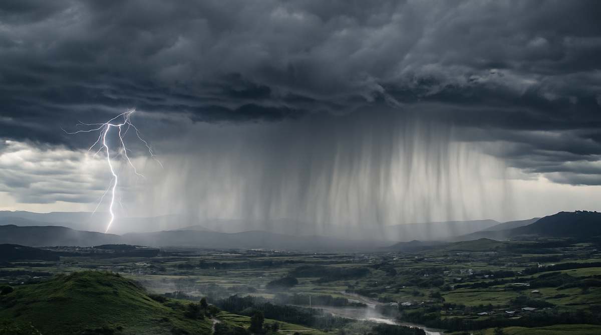
All Provincial Disaster Management Teams across KwaZulu-Natal are on high alert after the South African Weather Service (SAWS) issued an Orange Level 5 warning, as well as Yellow Level 4 and Yellow Level 2 warnings, for severe thunderstorms that will strike the province over the next two days.
To learn more about the colour system from SAWS, click here.
Yellow Level 2 Warning – Saturday, 22 November 2025
Turning first to the Yellow Level 2 warning forecast for Saturday, 22 November 2025, SAWS stated that a surface trough dominating the western interior, supported by an upper trough situated west of the country, will produce isolated to scattered showers and thundershowers over KwaZulu-Natal.

While many will remain moderate, some thunderstorms are forecast to turn severe, bringing heavy downpours, damaging winds, excessive lightning, and large amounts of small hail that will cause localised but serious impacts.
These impacts include:
- Localised damage to infrastructure and settlements
- Localised flooding of susceptible roads and bridges
- Minor motor vehicle accidents due to slippery roads and poor visibility
- Difficult driving conditions on dirt roads and slippery roads
- Large amounts of both small and large hail over open areas
According to the weather service, the following towns are predicted to be impacted by these storms:
- Vryheid
- Newcastle
- Ladysmith
- Indaka
- Dannhauser
- Dundee
- eDumbe
- Utrecht
- Impendle
- Estcourt
- Sobabili
- Mooi River
- Msinga
- The Msunduzi
- uMgeni
- Okhahlamba
- Giant’s Castle
- Mpofana
In light of this forecast, SAWS has warned the public to avoid travelling on bridges and roads in low-lying areas that are prone to flooding or sinkholes.
Furthermore, outdoor activities must be avoided entirely, as lightning, hail, and flash flooding pose a direct threat to life. Residents are therefore urged to remain indoors, stay clear of windows, and secure pets, livestock, and vehicles.
Orange Level 5 Warning – Sunday, 23 November 2025
Building on this outlook, SAWS has also issued an Orange Level 5 warning for severe thunderstorms on Sunday, 23 November 2025, covering eThekwini, Mkhambathini, Ray Nkonyeni, Richmond, Umzimkhulu, Ubuhlebezwe, Umdoni, uMuziwabantu, and Umzumbe.
From Sunday onward, widespread showers and thundershowers are expected across most of KwaZulu-Natal, with only the north-west experiencing scattered activity. Models show rainfall exceeding 50 mm in the south-eastern sectors, which remain saturated and highly vulnerable following recent heavy precipitation.
SAWS stressed that major impacts are anticipated. These include:
- Flooding of settlements, which may lead to displacements of affected communities
- Danger to life in areas of fast-flowing streams and rivers
- Mudslides, rockfalls, and soil erosion
- Flooding of roads and damage to bridges, which may lead to road closures and the disruption of traffic flow
Given the heightened risk, communities in these areas are strongly advised to stay indoors and avoid all roads unless absolutely necessary. Moreover, SAWS has explicitly warned against crossing swollen rivers or streams—even 15 cm of moving water can sweep a vehicle away—and motorists trapped by rising water must abandon their vehicles without delay and move to higher ground.
Yellow Level 4 Warning – Sunday, 23 November 2025
At the same time, the South African Weather Service has issued a Yellow Level 4 warning for severe thunderstorms on Sunday, 23 November 2025, affecting the following towns:
- Underberg
- Kokstad
- Ingwe
- Vryheid
- Newcastle
- Ladysmith
- Indaka
- Dannhauser
- Dundee
- eDumbe
- Utrecht
- Impendle
- Estcourt
- Sobabili
- Mooi River
- Msinga
- The Msunduzi
- uMgeni
- Okhahlamba
- Giant’s Castle
- Mpofana
- KwaDukuza
- Mtubatuba
- Nongoma
As SAWS further explained, a surface trough over the interior, together with a coastal low along the south coast and an upper-air trough over the central interior, will sustain widespread showers and thundershowers across KwaZulu-Natal, although scattered in the north-west.
Some of these thunderstorms are expected to become severe, accompanied by heavy downpours, damaging winds, excessive lightning, and large amounts of small hail.
Furthermore, SAWS warned that these storms could result in the flooding of roads, bridges, and both formal and informal settlements, as well as infrastructure damage from hail and possible lightning-induced fires. The risk of loss of life in fast-flowing water remains particularly acute. Residents are therefore cautioned to stay indoors wherever possible and avoid low-lying roads and bridges.
Motorists are again reminded to abandon vehicles immediately if caught in flash floods and seek higher ground without delay.
With thunderstorms now threatening an already waterlogged KwaZulu-Natal, the Provincial Disaster Management Centre and the KwaZulu-Natal Department of Cooperative Governance and Traditional Affairs (KZN CoGTA) are maintaining close surveillance and coordinating full-scale response preparations across all affected districts.
“In preparation for potential impact, several key government agencies and essential service providers have been activated and are on standby to respond swiftly to any incidents,” stated the department.
Finally, KZNCoGTA has called upon residents in identified high-risk areas to exercise extreme vigilance and comply fully with all safety directives.
“Residents are strongly urged to heed the weather warning and strictly follow all instructions and guidance provided by Disaster Management officials and law enforcement. The expected adverse weather conditions have the potential to disrupt infrastructure, including roads and essential services such as electricity supply,” concluded KZN CoGTA.
This weekend’s weather system is bearing down on a province that is already at breaking point. After weeks of relentless rain, KwaZulu-Natal’s rivers are swollen, its soils saturated, and its communities exhausted. One more intense storm cell could push entire districts past the tipping point, turning roads into rivers and homes into islands within hours.

The message from both SAWS and KZN CoGTA could not be starker: treat these warnings as an immediate order to act. Stay indoors, stay off the roads, and if water rises—move to high ground without hesitation.
With response teams stretched and access routes increasingly compromised, self-reliance and strict compliance with directives now stand between safety and catastrophe. This is not a drill; the next 48 hours will test the province’s resilience to its limit.
Do not forget to read, South Africa’s Toll Gate Fees 2025: The Ultimate Festive Season Travel Intelligence Guide, if you are planning to travel this festive season.