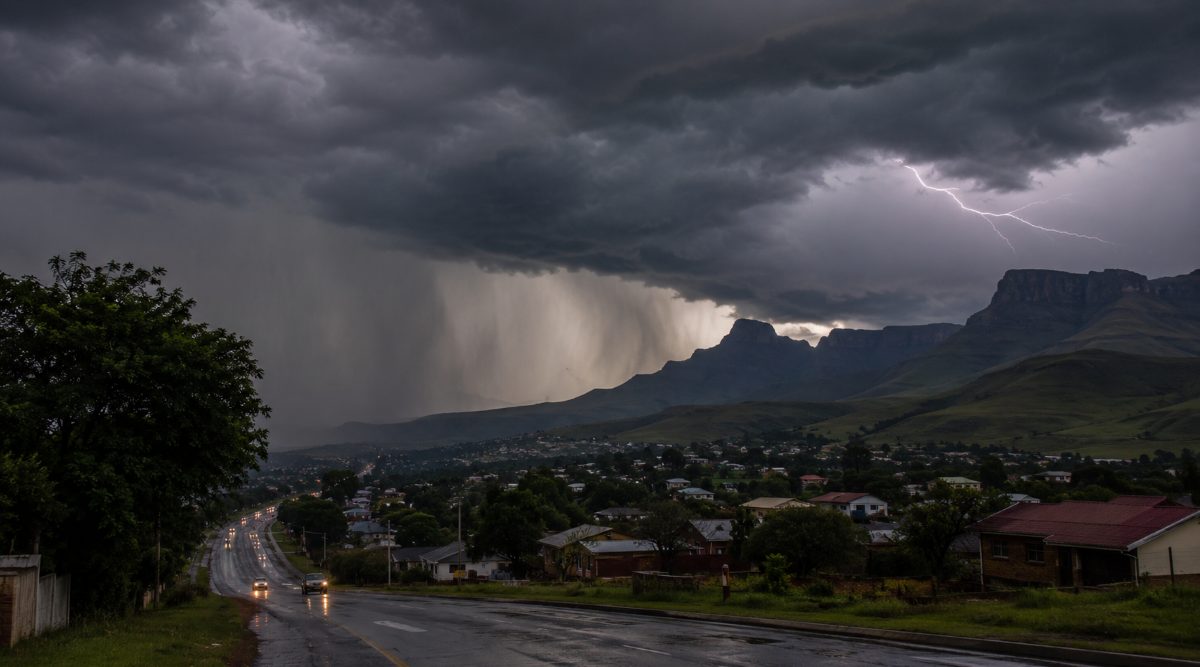
As a cold front continues to sweep across South Africa, bringing a marked drop in temperatures across several provinces, communities in KwaZulu-Natal have been urged to prepare for severe thunderstorms.
This follows a warning issued by the South African Weather Service (SAWS), which has forecast disruptive conditions including heavy downpours, lightning, damaging winds, and large amounts of small hail, all of which may result in localised flooding and damage to infrastructure.
Tell your story to the world. Paid editorial options starting at R12 500. Email: [email protected]
According to the Yellow Level 2 Warning for Severe Thunderstorms issued by SAWS, a cut-off low-pressure system is expected to generate widespread to scattered showers and thundershowers over KwaZulu-Natal on Thursday, 4 June 2026, extending into the north-eastern parts of the province on Friday morning, 5 June 2026.
SAWS has further cautioned that these thunderstorms may intensify in places, with the potential to become severe across much of the province.
The communities expected to be impacted by the inclement weather include:
Newcastle
Vryheid
Ladysmith
Hlabisa
Dannhauser
Underberg
Dundee
Mooi River
Estcourt
Jozini
eThekwini
KwaDukuza
In terms of expected impacts, SAWS has warned that the system may cause localised damage to infrastructure and settlements, as well as flooding of vulnerable bridges and road networks. In addition, motorists are likely to face difficult driving conditions due to slippery surfaces, reduced visibility, and intermittent hail.
Against this backdrop, SAWS has urged the public to exercise caution or avoid travelling on bridges and roads in low-lying areas, which remain particularly susceptible to flooding and possible sinkholes.
Furthermore, the weather service has advised against outdoor activities, noting that lightning, hail, and flooding may result in serious injury or loss of life. Accordingly, residents are also urged to ensure that pets, livestock, and vehicles are moved to safe locations.
Compounding these conditions, disaster response teams across KwaZulu-Natal have been placed on high alert ahead of a forecast cold snap expected to grip the province from Thursday, 4 June 2026, alongside the thunderstorms.
Authorities have warned that the combined systems could result in a sharp, sustained drop in temperatures and deteriorating weather conditions across the region.
“According to the official weather advisory issued by the South African Weather Service (SAWS), an intense Cut-Off Low pressure system is currently bringing bitterly cold, wet, and windy conditions to several provinces. While the heaviest disruptive rainfall is hitting the Western and Eastern Cape, KZN is going to see a sharp drop in temperatures, with light snowfall expected over the Drakensberg mountain range tomorrow, Thursday, 4 June 2026,” said MEC Buthelezi.
As previously reported by Newcastillian News on 2 June 2026, SAWS indicated that the system will bring “widespread bitterly cold, wet, and windy conditions” across several provinces, with light snowfall also expected over higher-lying mountainous regions, including the Drakensberg, further underscoring the severity of the approaching cold front.
Moreover, with specific reference to the N3 corridor, SAWS has indicated that while snowfall is expected over the Drakensberg mountains of KwaZulu-Natal on Thursday, 4 June 2026, current projections suggest that accumulation levels are unlikely to trigger significant disruption along the Van Reenen’s Pass section of the route.
Against this operational context, KZN CoGTA has confirmed that both the N3 corridor and Van Reenen’s Pass remain open and safe for travel at this stage, offering reassurance to motorists and logistics operators reliant on this key transport route.
“COGTA wants to reassure motorists, truck drivers, and the general public that, according to SAWS assessments, the expected snow is not anticipated to cause disruptions or closures over the Van Reenen’s Pass region of the N3 highway. KZN’s primary economic route remains open and safe. However, we urge all road users to keep a safe following distance, turn on their headlights, and drive with extra care in the wet and cold conditions,” the provincial department stressed.
Meanwhile, while urging communities to remain cautious and prepared, MEC Buthelezi confirmed that disaster response mechanisms have already been activated across the province.
“Our Provincial Disaster Management Centre has activated the necessary response protocols and placed municipal disaster teams on high alert. Emergency crews are monitoring high-risk areas closely and are ready to step in should the weather take an unexpected turn for the worse.”
With conditions expected to remain unstable as the system progresses, authorities have stressed that the priority for residents is maintaining real-time awareness through verified channels.
Given the speed at which severe thunderstorms can develop and shift, timely access to accurate information remains critical in reducing avoidable risk.
In line with this, communities across KwaZulu-Natal are urged to rely on updates from the South African Weather Service and established media outlets, while taking practical steps to remain protected as cold and wet conditions persist. Staying indoors where possible, limiting exposure during storm activity, and preparing for dropping temperatures remain key as the province moves through this unsettled weather period.
Newcastillian News invites your input. We ask that you keep your remarks courteous and on-topic. We do not allow any form of hate speech, such as racist or sexist comments. All comments are subject to moderation in line with our User Rules and Commenting Policy.